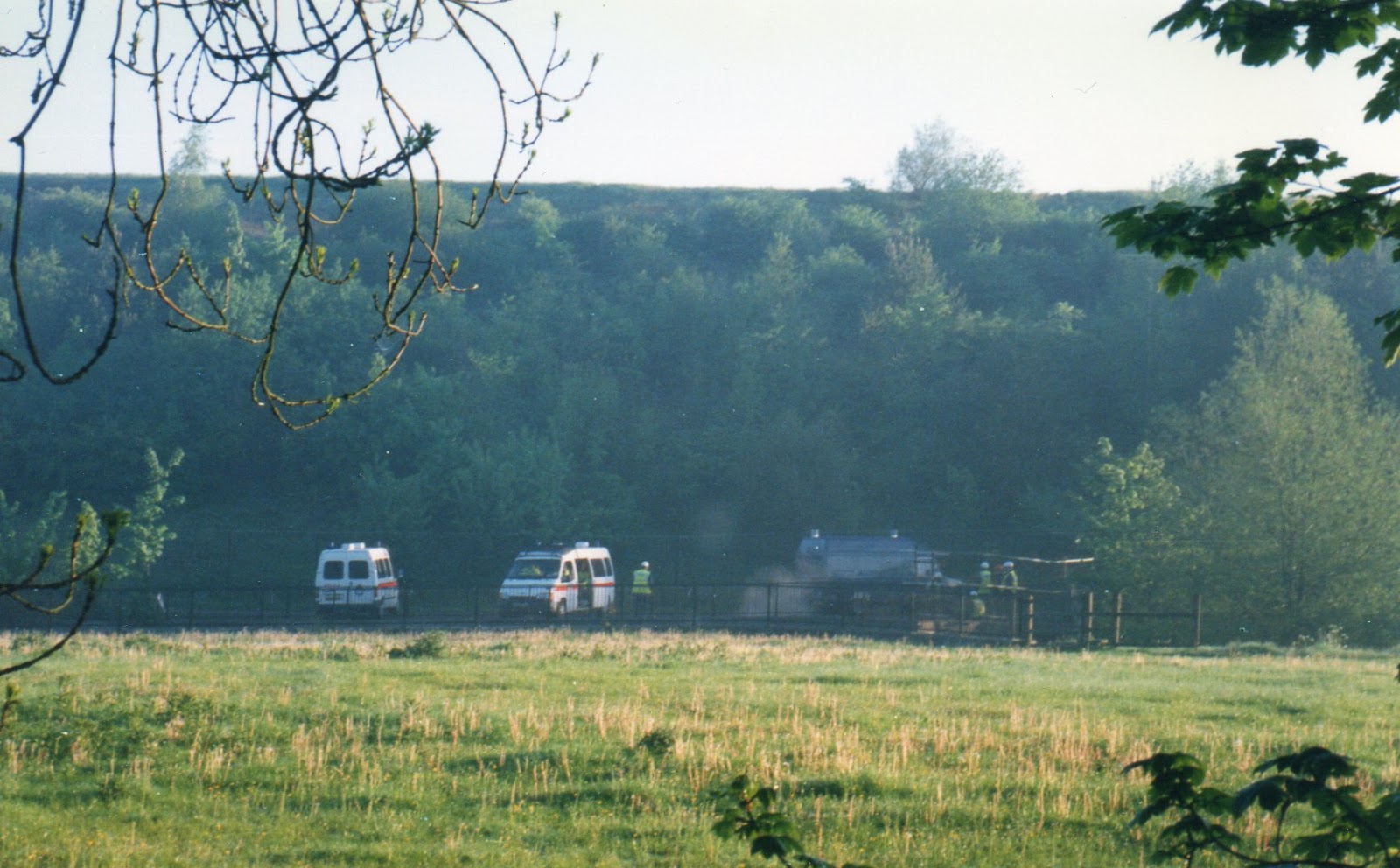
Green politics, philosophy, history, paganism and a lot of self righteous grandstanding.

Showing posts with label Walks. Show all posts

Saturday, 18 May 2013

Protest Walks #2: Bluebells in Stanworth Valley

This is a five hour walk through Lancashire countryside that takes in a secret Holy Well, a tower celebrating a Victorian right to roam and the scene of Britain's first almost entirely aerial road protest.

The walk starts at the Roddlesworth Cafe and Information Centre Tockholes, Darwen, Lancashire, BB3 0PA. There is a public car park next to the Royal Arms pub and the number 223 bus runs between Blackburn and Tockholes four times a day.

The best map is the Ordnance Survey Explorer Map 287.

There is some climbing and, this being Lancashire, it can be a bit wet underfoot.

Actually, very wet.

1. Hollinshead Hall

Opposite the cafe is the Tockholes plantation, an area of broad leaf woodland that surrounds some reservoirs. Cross the road from the cafe and follow the path that descends into the trees. When it crosses a paved path turn left. About a mile and a half further on you come to the back of a car park that is now permanently shut. Continue on about 200 meters and you find yourself in the remains of the enigmatic Hollinshead Hall. 

This is now in ruins except for one building, the Well House.

Little is known about the origins of this hall, which dates from some time in the Middle Ages but was abandoned in the late nineteenth century and then demolished in the twentieth.

The Well House is kept locked today, but inside you can just about make out the sculptured lion's head out of which the water flows, flanked by two stone troughs. Above and behind the building is another stone trough, which is accessible.

This all suggests something important, but what?

The name of the hall may not come from the Hollinshead family, or it may be derived from the Old English haeligewielle meaning holy well, which then became Holy Head and hence Hollinshead. This is backed up by the 1845 book Mansions of England mentions the Well House and says it used to be called 'Thee Holy Spring'.


So we may have an Anglo-Saxon holy well, but that's not all. The building is inscribed with the coat of arms of the Radcliffe family, which used to own the land. The Radcliffe's were Catholics and if the well house dates to the 1680s, as it appears to, they may very well have been using it as secret baptistery.

On top of that the place is apparently haunted, although the time I spent the night here - admittedly in the back of a transit van and not the Well House - I didn't notice anything out of the ordinary.

Whatever you make of it, enjoy the peace of the woods around the halls, as it's likely to get a bit windy as we go on.

2. Jubilee Tower

Return to the closed car park and cross the road. On the other side, a few meters to your right, a large sign welcomes you to the West Pennine Moors. Follow the stone signs which show the way to Jubilee Tower, also known as Darwen Tower, which soon comes into sight in front of you, standing on Beacon Hill like a Victorian space rocket waiting for blast off.

The best time to do this bit of the walk is mid-August, when the heather is purple. I did it in May, when the wind was a tad more bracing.

The tower gets its name as it was completed for Queen Victoria's Diamond Jubilee, but it also marks a rare victory in the ancient battle for a Right to Roam.

In 1870 the local absentee land owner had closed the moor to people and turned it over to grouse. A local man, William Thomas Ashton, crossed the moor regularly to deliver coal, and whenever the gamekeepers blocked the path, he cleared it.

Eventually the matter ended up in court, where Ashton won.

The tower is open all year round, although you probably won't want to hang around too long at the top. From there you can see Kinder Scout, Blackpool Tower and on a good day the Isle of Man. However even on a bad day you should be able to see Winter Hill to the southeast. A fairly non-nondescript lump with radio transmitters on top, the hill was the scene of a less successful trespass in 1896.

3. Tockholes

Once you've finished pretending to Saruman in the tower leave Beacon Hill by taking the path north, following signs marked Witton Weavers Way. Once you leave the moor you take a left - but you can't see the sign until after you've passed it. The path then joins a concrete Water Board road. When it joins a tarmaced road keep right on the black stuff, eventually passing Earndale Reservoir on the left (pictured) and Sunnyhurst Woods on the right.

Once past the reservoir carry straight on and once you've gone up the hill turn right. You pass Belstone Stables on the right and the path becomes Weasel Lane, eventually emerging in Tockholes itself just opposite the United Reform Church.

If you've had enough your starting point is a mile down the road to the left.

If you're game to press on turn right and then left immediately after the church, going down Silk Hall. If you have a spare pound you could buy a snack or half a dozen eggs from Julie's Cake Box (pictured). At the end of the short road ignore the sign which suggests the path goes left and carry straight on across the field in front of you. Keep to the left of the wall and cross two styles.

When you reach a Chapels Lane turn right, passing the dramatic entrance to St Stephens Church. Unfortunately behind the fine gateway is a rather disappointing modern building.

Turn left after the church following the sign "Public Footpath" and at the end of the lane, where you appear to be in someone's garden, follow the sign "Rambler's Footpath".

This leads you out into a series of fields, linked by styles, and you should be heading towards the sound of traffic, still following the Witton Weavers Way.

Before you get there you you will find yourself in an area of woodland. I found myself in a field of bluebells, late thanks to snow in April (possibly caused by the premature melting of the Arctic ice) but still a very welcome sign that the season of Beltane was upon us.

On the other side of the woods though you cross a field and find a very different view; the westbound carriageway of the M65 motorway.

4. Canals, Railways and Motorways

Follow the path alongside the motorway, taking care to observe the interesting debris on its verges. When I was there these included plastic bags, fast food containers, a ring-binder file and what looked like a pair of trousers - an unusual thing to loose whilst heading towards Preston at 70mph.

In 1995, as part of the "biggest road building program since the Romans" the motorway was extended eastwards, with this bit being opened in 1997 by Jack Straw and a large contingent of police. One of the most deprived parts of the country received a major new transport link, and the 52,000 vehicles a day now fly through an area of
"Special Landscape Value".

When you reach the road, turn right and use the charmingly graffitied underpass to cross to the north side of the motorway. Mercifully, you are soon on a quiet country road again.  You pass an airgun range on the left. Ignore the Witton Weavers Way as it heads off right and stay on the road. You are looking for a footpath off on the left. It's hard to spot as it's signposted from a short road that joins on the left and is next to Stocklough House. If you get to some industrial units you've gone too far.

As you walk though the wood you cross an old stone bridge that is one of the relics of an earlier transport system; the Blackburn to Chorley line of the Lancashire Union Railway. It closed to passengers in 1960, three years before the Beeching axe fell on other branch lines. By the time the M65 extension was built, British Rail itself was being broken up and privatised and the West Coast Mainline was in such a parlous state seasoned travelers were allegedly getting off Scotland to London trains at Preston and getting buses to Manchester, which usually overtook the frequently held up trains.

The path emerges from the trees next to the Leeds-Liverpool canal, another transport system, and one the dates back to the dawn of the Industrial Revolution.

Today, people who oppose new roads look back nostalgically to the heyday of the railways. But when the railway boom was at its height, early environmentalists like William Morris and John Ruskin looked back fondly to the days of the canal. In Morris's Utopian story, The News From Nowhere, goods moved on barges powered by a mysterious clean energy source.

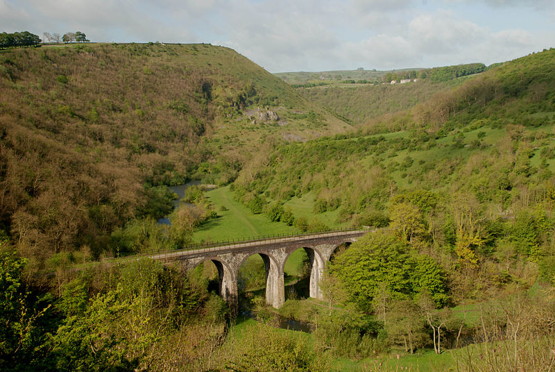
Ruskin meanwhile railed against the Headstone Viaduct at Monsul Head, claiming "The valley is gone, and the Gods with it". Seeing as how this is now subject to a preservation order and one of the most photographed structures in Derbyshire, you wonder what he would have made of what happened to Stanworth Valley.

5. Stanworth Valley

Opposition to the motorway extension started almost as soon as it was announced, but protests stepped up a gear when veterans of the campaign against the M11 in London moved into Cinderpath Woods in May 1994. They were evicted, and after several other preliminary skirmishes the protesters ended up accumulating in Stanworth Valley for a new experiment in direct action - living without the ground.

The valley being low lying, and the Lancashire weather being somewhat inclement, the bottom of the valley rapidly became a 'quog'. So the protesters took to the trees.

Not only would they have to be physically removed from the trees before the road could be built, but after a well-wisher from Cheshire had had a letter delivered to the occupants of a Sweet Chestnut tree standing in the path of a the M11, inhabited trees were recognised as legal dwellings and so formal eviction proceedings had to be held before clearance work could start.

Hidden away from the world in the valley, with less support from the locals than at other protests, the inhabitants of the 40 odd (some very odd) tree houses were mostly in a world of their own. People could loose each other for days along the four miles or more of rope walkway linking the twigloos.

When evictions eventually started the Under-Sheriffs men quickly cleared the ground, but struggled to clear the trees. Until they learnt to cut walkways with knives on poles, this left the security guards living like Morlocks on the ground whilst the elevated protesters moved freely above them.

The Under-Sheriffs men moved in on May morning 1995, after a raucous and skyclad Beltane party by the protestors. Previous tree evictions had used raised platforms called cherry pickers, but for the first time contracted climbers were brought in. This was a move that would eventually see the Sheffield based team who did eviction work ostracised by the rest of the climbing community, but here in Lancashire the main problem they faced was how to deal with people who moved through the trees without harnesses and showered them with pasta and baked beans.

Eventually the inevitable happened and the last protestors was removed and the trees felled.

Two bridge sections each of 270 meters in length and weighing over a thousand tons each were manoeuvred into place a hundred feet above the valley.

AMEC appear to be quite proud of the work, and it's true that the direct destruction only extends 10 meters either side of the road and that wildlife is free to pass under the motorway - not an insignificant fact as one of the worst things about busy roads is the way they divide up eco-systems into tiny islands.

However directly under the span of the bridge no plants grow and litter has rained down from the carriageway above into the beautiful valley.
 
6. Back to Tockholes

The path picks up the Witton Weavers Way again, which turns left and passes under the motorway on the west side of the valley. A couple of hundred meters further on you turn left again at a style and descend into the valley. 

Away from the M65 it is a pleasant place once again. Amongst the bluebells I found the remains of a firepit. What camping in the lee of a six lane motorway would be like I don't know, but that aside this is a magical spot.

The path crosses the stream at a wooden bridge, and when you ascend again you can see Jubilee Tower in front of you again. Another old bridge
means you've again crossed the trackbed of the Lancashire Union Railway. Continue on to Bradley Farm and turn right in the farmyard, leaving by a farm track that heads due south, again following the Witton Weavers Way.

At a confusingly signposted junction turn right and then almost immediately left. Don't go down the slope. You follow the vaguely marked path across fields staying to the left of the fence. Cross the valley at the footbridge by Red Lea
Farm. On the other side it joins a paved road. You can either turn right on the road, which soon doubles back on itself, or take a shortcut by following the footpath in front of you, but it is a bit steep. 

When the path rejoins the road turn left and head towards Abbey Village. Arrive in the village just behind the Hare and Hounds pub and turn left towards the rake Brook Reservoir. Just after the water turn left, still following the Witton Weavers Way. When you get to the Roddlesworth Reservoir turn left again, even though this puts the Jubilee Tower on your right. However the path follows the edge of the reservoir
back round to the east and towards where you started from.

The Witton Weavers Way eventually exits left, but ignore it and carry straight on on the main path. there are two Roddlesworth Reservoirs, and just after the second one the path you are on is crossed by a footpath. this is where we began and if you turn left you find yourself back at the cafe where we began. 

They sell locally produced produced and fairtrade food and organic pies, so if you've made it this far please treat yourself.

Thursday, 25 April 2013

Another World Is Possible: Port Sunlight

Port Sunlight was somewhere I'd heard of, but had never been to, until I passed through in February 1997 whilst campaigning for the Labour Party in the Wirral South Byelection. As I was given my leaflets I was quickly briefed on how the election had been called after the death of Barry Porter, which was a little bit of a shock as that was my Dad's name and I was counting on him for a lift back from the station.

Seeing the leafy gardens and Ford Mondeos I remember thinking that's there's more chance of Tranmere Rover getting promoted to the Premiership than Labour getting an MP returned here.

But Labour did indeed win, overturning an 8000 Conservative majority to return Ben Chapman, the son of a farm worker, to Westminister, a sign that eighteen years of Conservative rule may be about to come to an end. Tranmere Rover were less lucky though, missing out on the promotion play-offs again.

But if Bebington is now about as posh as Merseyside gets, Port Sunlight at least has a more proletarian past. It was built by the ruthless capitalist, paternalistic philanthropist, arch Imperialist and connoisseur of the arts William Lever, one of the two Lever Brothers who made their fortune out of Sunlight soap, who built the place to house his workforce.

Port Sunlight has two claims to fame, that it is an example of an ideal community designed by a wealthy industrialist, and that it is styled in the manner of the Arts and Craft Movement.

Lever wasn't the first Capitalist had built a decent place for the great unwashed to live. Richard Arkwright had used the prospect of good housing to persuade families to move to Cromford to work in the first every mill over a century earlier, and Robert Owen had been carrying out an experiment in Utopian socialism in New Lanark for more than eighty years before work started at Port Sunlight.

However whilst Owen was experimenting with Utopian socialism up in Scotland, Lever was very much the Liberal.

It's easy to look back nostalgically at old Liberals like Lever. After all, they're so much nicer than the Neoliberals we have today. Today, Sunlight soap would be made in a sweat shop in Burma, with the Levers holed up in a tax haven on the other side of the world.

But there were always limits to the liberalism of people like Lever.

Yes, the great unwashed could be decently housed and guided to live more righteous lives, but their wages would increase by less than his wealth, and nobody had the right to stop Lever's brand of laissez faire capitalism spreading round the world.

There was also no local democracy here, or any attempt at communal living like in New Lanark. Instead Lever knew exactly how he wanted to clean up the Working Class who moved into his houses, and so he dictated exactly how they should live their lives.

George Orwell called in on his way to Wigan Pier in 1936. He liked the houses and the low rents, but was unhappy about the rules and regulations Lever set control his tenants, seemingly on the basis that it was slum dweller that made the slum. Orwell, knew that the pub was an imprtant part of Working Class life, and who wrote an essay on the perfect English pub, lamented the one "dismal sham-Tudor" pub provided.

Neither can we really claim that Port Sunlight is the best example of Arts and Crafts style housing in Britain. That's probably Blackwell in the Lake District for the real thing, or Wightwick Manor in Wolverhampton, a place which made Andrew Lloyd Weber cry, for an off-the-peg example.

However it is fairly unique in that it is Arts and Crafts houses for the ordinary man, which is actually a bit disappointing for a movement that aimed to improve the lives of the ordinary man.

The Arts and Crafts movement was inspired by the radical Conservative John Ruskin and the anarchic Socialist William Morris.  Both were
equally horrified by the shoddy goods that the Industrial Revolution was producing and the shoddy lives led by the industrial Working Class.

It's noble aim was to take on Adam Smith's division of labour, replace the wage slave with the skilled craftsman and give everyone beautifully designed and hand crafted objects.

Unfortunately these ideals could rarely be realised in real life. Objects could be beautiful or mass produced, handmade or cheap, but they couldn't be beautiful and cheap without either working with industry or working for industrialists. So at Port Sunlight we have one of the world's most successful Capitalists building houses in the style of a movement that opposed everything about the way he did business.

Since 1980 you haven't needed to work for soap factory to buy a house in Port Sunlight. House prices are about the national average, although a little higher than the Merseyside average, and all told the area appears to be for the moderately well off rather than stock brokers. Certainly the VWs
outnumber the Mercedes.

There are still rules and regulations if you live there, but there's nothing to stop soap dodgers like me turning up for a nosey round.

The village is centred round the war memorial, which stands opposite the Lady Lever art gallery. It may seem strange that the village is built around a memorial to a war that happened forty years after it was built, but apparently they were saving the
spot for a postumous cast of Lever himself.
Beyond the War Memorial is the Lady Lever Art Gallery, where Lord Lever showed off his art collection. I don't know what his employees made of it, but he was very keen to show them. It has really a great collection of work by those other rebels against the industrialised world - the Pre-Raphaelite Brotherhood. Like the Arts and Crafts people, the PRB had a mixed relationship with the Establishment they'd set out to rock.

Like Orwell, I want my idyllic cottages a less neat and my life a bit less controlled than Lord Lever would have liked.

All told Port Sunlight shows what's possible when philanthropy meets good design. There's no reason why our cities shouldn't be beautiful as well as useful, human sized rather than supersized.

Another world is possible.

Wednesday, 10 April 2013

Protest Walks #1: Wild Garlic at Manchester Airport

Being a circular walk through the Cheshire countryside taking us from the Iron Age to the Jet Age via the birth of the Industrial Revolution.

Approximately 8 miles, taking about three and a half hours, mostly on good paths (but with one muddy bit though) and involving very little climbing.

OS Explorer Map 268 Wilmslow, Macclesfield & Congleton

Starting point: Car Park on Lindow Common

1. Lindow Common

Lindow Common
The walk starts on Lindow Common, a Sight of Special Scientific Interest to the west of the prosperous commuter belt town of Wilmslow. The area may be Footballers Wives, but here on the common you can see why the Ancient Britons regarded this area as a liminal place, neither earth nor sea.

At the centre is the Black Lake, which in Welsh in llyn ddu, from which we get Lindow. Visit at twilight and you get an idea of how the Ancient Brits could regard the shadowy reflections in its waters as glimpses into the Otherworld.

When you are done exploring, leave the Common by the southwest exit, cross Racecourse Road and walk down Lindow Lane, marked as a dead end. Carry on until you reach a T junction at Racecourse Farm and turn left. Carry straight on at a crossroads of footpaths and byways until you come to another T junction where you join Rotherwood Road.

2. Lindow Man

Reconstruction of Lindow Man
You are now on the edge of the field in which the head of Lindow Woman was found. The police used the discovery to prompt a Mr Reyn-Bardt to confess to the murder of his wife in 1960, but it turned out the body was much more interesting, being nearly 2000 years old.

The next year the even better preserved body of Lindow Man, known locally as Pete Marsh, was found. A young man who had done no hard labour prior to his death by strangulation, a blow to the head and possibly drowning, he also had traces of mistletoe in his stomach. Mistletoe being sacred to the Druids, his 'triple death' in this liminal place suggested human sacrifice. Radio carbon dating places his death in approximately the first century AD, right about the time that the Romans were conquering this part of the known world. Could Lindow Man have been an offering to the Gods, asking them to turn back the seemingly unstoppable legions with their suspiciously straight roads? Protest AD60 style.

Peat cutting in 2015
Incidentally, ignore the grid reference for the location of the find given on Wikipedia, in the guide book and the various press releases. That puts Pete right in the middle of a definitely not Iron Age former corporation rubbish dump about a kilometre north of here. That was deliberately misinformation to put off looters. The actual spot is just off Moor Lane, near the houses you can see on the far side of the field.

Peat cutting has now finished here, so nobody knows if there are more bodies waiting to be discovered, including the unfortunately Mrs Reyn-Bardt?

3. Morley Green

Mist on Lindow Moss
There isn't much to see in the field today, unless you are lucky enough to experience one of the ethereal mists that come down on the moss and seemingly take you back 2000 years.

Peat cutting and draining of the area has changed the ecology completely, but the community here on the Moss does still feel removed from the outside world.

Turn right on Rotherwood Road and keep walking until you see a sign for a Private Nature Reserve. By now aircraft noise is probably starting to become a feature of the walk.

Carry straight on, following the purple signs for Lauren's Ride and Bridal Path to Morley. the road becomes a path and then a road again, bearing right until it arrives in the middle of Morley Green.

Morley Green
Cross the road, leaving the village sign on the green to the right and the Cheshire Smokehouse on the left. Continue down the road for about 500m, ignoring the footpath on the right, but taking the one on the left a few yards further on marked Castle Mill.

This leads to a path that soon becomes rather muddy that take you towards Manchester Airport. You will see a red and white radar dish in front of you.

If you wish a walk unspoilt by the twentieth century you can take the footpath through the metal kissing gate on the right and rejoin the walk at the Holiday Inn. However as the whole point of this walk is to visit the sight of events in 1997 I suggest you carry straight on, following the path which keeps left when you get to a triangular field.

4. Wild Garlic

Wild Garlic in the Bollin Valley
The path descends towards a wooden bridge and here should find yourself assaulted by the scent of wild garlic. When asked to describe the smells of the protests of the 1990s may aromas come to mind, but the most pleasant ones were wood smoke and wild garlic.

Here in the Bollin Valley we were immersed in the garlic from dawn to dusk. Sometimes, when we were hard up, it was added 'frasiers' - cakes made from self raising flour and water - which made something resembling food, but only just. I would like to say that after months of living in the camps I was infused with garlic too, but most people would say I smelt of much worse.

Not far past this bridge, you come to another junction. Take the footpath to the right marked Bollin Valley Way.

Eviction day, May 1997
If this was 1997 you would now be headed towards a security fence, lit at night by arc lights, and patrolled by Police, Bailiffs and up to 500 security guards. All this was to remove less than a hundred protesters from the sight of Manchester Airports second runway. The camps were first surrounded by wire and guards, and then the protesters were slowly removed from their treetop houses and tunnels.

Bored security, 1997
I was evicted on the first day, but I returned three days later, at night, along the path you have just walked with Ollie Big Dog and Kim. Our aim was to get back to our camp, appropriately enough called Wild Garlic, which was being evicted. We slipped between the security guards, climbed the fence at a spot where the barbed wire was missing, and evaded the bailiffs who were patrolling on quad bikes with night vision devices. I created a diversion whilst Ollie and Kim made a run for it. They didn't make it.

A few days later I returned with a BBC documentary maker. She too wanted to get inside the security perimeter. She'd asked for a cameraman, and had hoped for some young hotshot with a camcorder. instead she got a grizzled old veteran with a camera the size of a suitcase, who regaled us with stories of wars he's covered around the globe whilst we blundered around in the dark. The film never got made.

5. CAR2

Zion Tree
As you walk towards the sound of jet engines you will see the incongruous sight of fully laden jumbo jets rising slowly over the Cheshire Countryside. During the days of the campaign Against Runway 2 the aircraft appeared to grave the top of the great beech of Zion Tree camp.

The camps were located either side of the large tunnel you can now see in front of you, which was build to accommodate the River Bollin.

In 1997 protesters, and journalists looking for a scoop, soon discovered the limitations of security guards paid less than what is now the minimum wage. On dry land they'd hand you over to the police, but faced by a river a few inches deep they decided to keep their feet dry and you could walk into the site unmolested along the river.

When you join the path that runs round the perimeter of the runway, next to a wooden bridge, you will find a sign board that tells you that archaeologists discovered during the building of the runway that our medieval camps were built on the sight of a iron age farmstead. It would be too much to imagine that Lindow Man came from here, but it's not impossible.
Manchester Airport Tunnel, 1997

To visit the site of the camps themselves, take a little diversion into the tunnel.

On the right, as you enter, would have been River Rats, which you reached form here via a dodgy rope walk over the river. Beyond that would have been the Camp Cliff Richard (funny how we never got the press to run that line, especially once it had been penetrated by the Sheriffs men) where Swampy and the serious protesters lived. Beyond that and nearer the road was Flywood, home of the leery, beery trolls who snaffled the prized donations of food and booze.

Manchester Airport Tunnel, 2013
Towards the end of the tunnel and also on the right would have been Zion Tree, and on the left my own camp called, appropriately enough, Wild Garlic. No occupied trees survive, but if you carry on out of the tunnel and into the bushes on the far side you come to a steep bank on the left with a muddy ditch in front of it. technically this was probably part of Wild Garlic camp, and the ditch became our moat, complete with drawbridge. On the day it was defeated by a copper with longer than average legs, but it looked the part.

Wild Garlic camp, 1997

Although the poor old yellow hatted security guards were paid peanuts, the expert climbers and rescuers used to get the protesters out of the tree houses and tunnels were collecting a hundred pounds an hour or so for their work. We tried to make their job as hard as possible.

One of the more colourful characters in Wild Garlic was Carl, who came from a rather interesting family in New Brighton. Carl was the proud owner of more piercing than anyone else, and he tried to use these to aid the defences of the camp.

Carl meets the press with nail
When the climbers reached his tree house they found him lying with his head against the wooden pallet that made up the floor, attempting to hammer a six inch nail though the hole where his large ear stud had been using the blunt end of a hand axe. It didn't work, the nail wouldn't go into the wood, but when he gave up the climbers told him to lie back down again as they could get an hours extra work out of this. They ordered up some special tools, and then spent the next hour chatting and smoking with Carl.

My own contribution to the defence of the camp was rather more limited. Eviction day found me on day patrol. Down by the bridge across to Zion Tree i met some men in black balaclavas across the water. "Hello," I said, assuming they were with us. "F*** Off," came the reply, as they weren't. They were either a special police unit, or more likely the SAS anti-terrorist unit, called in after bogus claims we'd booby trapped the woods. They demolished the bridge, leaving the River Bollin between me and them, which I thought was a good idea. We'd though Wild Garlic would be hit first and I'd volunteered to help local activist Jeff Gazzard with the PR, so my camping days ended rather mildly as I walked off the site voluntarily.

6. The Airport

Manchester Airport
Return to the bridge and turn left out of the tunnel, heading north. As you climb up towards the fire station you will see the whole of Manchester Airport to your left. A marvellous technological achievement, modern air travel has joined the world together like no other achievement. At any one time there is the equivalent of the population of Manchester in the air. On 99 days out of 100 every single one of those passengers will arrive safely, which isn't something you can say about many means of transport.

However it is an achievement only made possible by the chance existence of oil. The kerosene used as aviation fuel has twice the energy density of TNT, and every day Manchester Airport uses 3000 tons of the stuff. As it combines with oxygen when it is burnt, a ton of aviation fuel produces three and a half times its own weight in carbon dioxide, a greenhouse gas and the primary component on man-made Climate Change. In addition the vapour trails of high flying jets also heats the air. A quick back-of-an-envelope calculation suggests that the airports contribution to Global Warming is of the same order of magnitude as the rest of the city of Manchester.

7. Styal Country Park

Yet more wild garlic...
Continue along the Runway 2 Trail. After the Fire Station the path is badly marked and continues across the grass, not down the access road. Eventually you descend down some steps to the A538, by a roundabout and near the Holiday Inn. in 1997 this was the Moat House. It didn't usually serve protesters, but if you hung around long enough you'd usually find a journalist willing to buy you a drink for a story.

Cross the main road and continue down the unused road off the roundabout to the north. It can be used as an unofficial car park, as it was in 1997, if you want to start the walk here. Had you been here on the morning of May you'd have found a bedraggled group of survivors from Zion Tree, including a journalist with a bleeding ear, and a battery of press trucks which included everything from ITN to L!VE TV - although neither the News Bunny nor any Topless Darts players were seen.
Styal Cross

At the end of the short road a sign shows you are entering National Trust land. Go through the gate and follow the path, keeping right when it branches after about 100m. You are now following the River Bollin as it meanders through a low gorge.

On the left in Arthur's Wood, the scene of another protest in 1999 when more trees were cut down during the construction of the second runway.

Cross the river at Giant's Castle Bridge then again at Oxbow bridge. The paths multiply as you enter Styal Country Park and if your not careful you can find yourself going round in circles. I kept left after Oxbow Bridge, crossed a dry valley on Chapel Bridge, and then at a small metal bridge turn left.

This takes you along the holly hedge that borders Norcliffe Chapel and then on to Styal Cross, a Victorian erection on a medieval base that has had a number of adventurers before returning to its original site a few years ago. Go through the gate marker Quarry Bank Mill.

8. Quarry Bank Mill

Quarry Bank Mill
So how did we get from venerating nature as the home of the gods (and sacrificing the odd posh person to her) to seeing it as both the source of a free lunch and a dustbin that never needs emptying?

Part of the answer is here at the mill, for we are now at the birth of the Industrial Revolution.

Built by Samuel Greg 1784, just 13 years after Richard Arkwright showed the way at Cromford, and before the steam engine was a viable concept, this water powered mill showed the future.

The scale of the mill was, for its day, astounding. But the mill didn't just represent technological step change, but a social one as well. For the first time, the working day was set by something other than the natural cycle of the earth, as people served the machines and not the other way round.

Styal Village
Whole families worked here, including children from the workhouse who weren't paid. the Greg family also owned slaves in the West Indies, but forced labour for white children continued here for years after it was outlawed for black adults.

So why did people give up their pastoral existence to become wage slaves in a Dark Satanic Mill. You've actually just walked past the answer; the picturesque Styal Village. The mill offered regular work, regular wages and a place to live, something worth the loss of the occasional finger.

Things got better of course, and it was the much maligned Victorians who sorted the factories out. But Dark Satanic Mills still exist, just not in this country, and the products of their sweated labour arrive in this country in part via Manchester Airport.

9. Wilmslow

Explore the mill if you want to, then take the path in front of the Mill Pantry marked "Picnic Area". Continue on a path that again takes you along the River Bollin. There's a diversion to the weir and further on it diverges again, but whichever route you take you eventual end up at the B5166. Turn right and cross the river on the foot bridge next to the road bridge and continue to the car park you see in front of you.

Cross the river again at the bridge and continue straight, ignoring a path to the left. Continue on past the rugby ground on Kings Road. You are now in Wilmslow, home to stars of the Premier League and Coronation Street, and a thriving Aston Martin dealership. At the end of Kings Road is the A538, along which I used to trudge in 1997 on the way to the off license. Well, there wasn't much else to do in the evening at the camps.

At the end of Kings Road turn left to the Premier Inn, on the other side of which is Lindow Moss where we started.


The route:

Leave Lindow Common by the southwest exit, cross Racecourse Road and walk down Lindow Lane, marked as a dead end. Carry on until you reach a T junction at Racecourse farm and turn left. Carry straight on at a crossroads of footpaths and byways until you come to another T junction where you join Rotherwood Road.

Turn right on Rotherwood Road and keep walking until you see a sign for a Private Nature Reserve. Carry straight on, following the purple signs for Lauren's Ride and Bridal Path to Morley. the road becomes a path and then a road again, bearing right until it arrives in the middle of Morley Green.

Cross the road, leaving the village sign on the green to the right and the Cheshire Smokehouse on the left. Continue down the road for about 500m, ignoring the footpath on the right, but taking the one on the left a few yards further on marked Castle Mill.

This leads to a path that soon becomes rather muddy that take you towards Manchester Airport. You will see a red and white radar dish in front of you. Carry straight on, following the path which keeps left when you get to a triangular field.

The path descends towards a wooden bridge. Not far past this bridge, you come to another junction. Take the footpath to the right marked Bollin Valley Way. By the tunnel under runway, join the Runway 2 Trail and turn right over the bridge.

Continue along the Runway 2 Trail. After the Fire Station the path is badly marked and continues across the grass, not down the access road. Eventually you descend down some steps to the A538, by a roundabout and near the Holiday Inn.

Cross the main road and continue down the unused road off the roundabout to the north. At the end of the short road go through the gate marked National Trust and follow the path, keeping right when it branches after about 100m, following the river. Cross the river at Giant's Castle Bridge then again at Oxbow bridge and keep left. Cross a dry valley on Chapel Bridge, and then at a small metal bridge turn left.

Follow the holly hedge that borders Norcliffe Chapel and then on to Styal Cross. Go through the gate marker Quarry Bank Mill.

Take the path in front of the Mill Pantry marked "Picnic Area". Continue on a path that again takes you along the River Bollin. There's a diversion to the weir and further on it diverges again, but whichever route you take you eventual end up at the B5166. Turn right and cross the river on the foot bridge next to the road bridge and continue to the car park you see in front of you.
 
Cross the river again at the bridge and continue straight, ignoring a path to the left. Continue on past the rugby ground on Kings Road.

At the end of Kings Road turn left to the Premier Inn, on the other side of which is Lindow Moss where we started.